
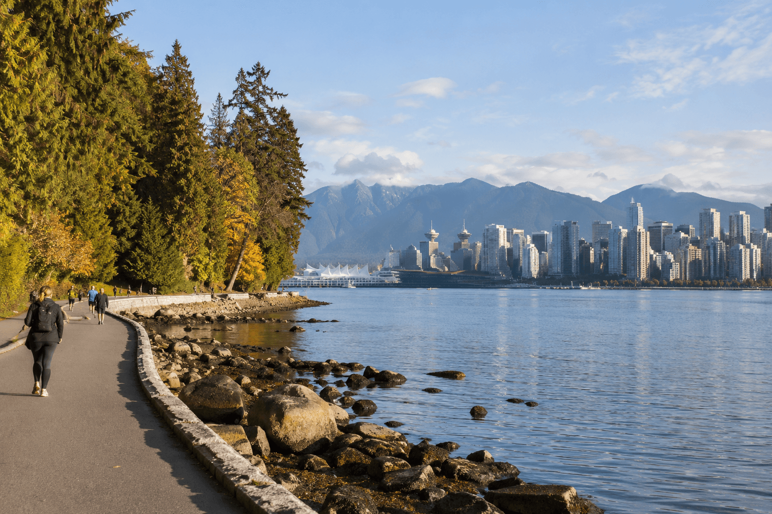
Vancouver is best understood where the city meets the water. This self-guided route follows the edge of Coal Harbour into Stanley Park and finishes beside English Bay, combining skyline views, forest, Indigenous presence and an easy sense of direction. Allow three to four hours for an unhurried walk, longer if you stop at beaches or viewpoints.
Why this Vancouver walk works
The route is scenic without being complicated. It begins near the downtown peninsula, stays beside the shoreline and can be shortened at several points. Before setting out, use the AI Tour Matcher to compare the walk with guided options available for your dates.
Stage 1: Coal Harbour to Brockton Point
Start among marinas and mountain views
Begin around Canada Place and walk west through Coal Harbour. The contrast is distinctly Vancouver: glass towers behind you, working harbour ahead and the North Shore mountains across the water. Continue past the marina toward Stanley Park, keeping to the pedestrian side of the path.
Enter Stanley Park slowly
Near Brockton Point, pause for the lighthouse, harbour traffic and the totem poles at Brockton Point. They represent First Nations artistic traditions; approach the site as a cultural place rather than simply a photo stop. Interpretive signs add essential context.
Stage 2: Around the Stanley Park Seawall
The full park loop adds distance, but the scenery changes constantly: forested cliffs, Lions Gate Bridge, open water and small beaches. Pedestrians and cyclists have designated directions and lanes in several sections, so follow posted signs. Weather, maintenance or storm damage can occasionally close parts of the route; check the City of Vancouver’s official Stanley Park and seawall notices before leaving.
Where to pause
Brockton Point, the view toward Lions Gate Bridge and Second Beach are natural breaks. Carry water and a light waterproof layer: conditions can change quickly even on a bright morning.
Stage 3: Second Beach to English Bay
From Second Beach, continue south toward English Bay. The final section feels more urban again, with cafés, swimmers and sunset watchers. If you want a richer introduction before walking independently, browse the free walking tours; for food, bike and cultural alternatives, compare the experiences.
Practical planning
- Best time: morning for quieter paths; late afternoon for warmer light.
- Distance: adaptable, roughly 8–12 km depending on the park loop.
- Transport: downtown is well served by SkyTrain and buses; check TransLink for live service information.
- Respect: stay on marked paths, give wildlife space and take all litter away.
Frequently asked questions
Can I do the Vancouver Seawall walk in one day?
Yes. A focused Coal Harbour–Stanley Park–English Bay route fits comfortably into half a day.
Is the route suitable in rain?
Light rain is common and manageable with waterproof clothing, but obey closure notices during high winds or storms.
Should I walk or cycle?
Walking allows more stops and close observation. Cycling covers the full loop faster, but lane and direction rules must be followed.
Information checked against the City of Vancouver, Destination Vancouver and TransLink official resources on 4 October 2026.