
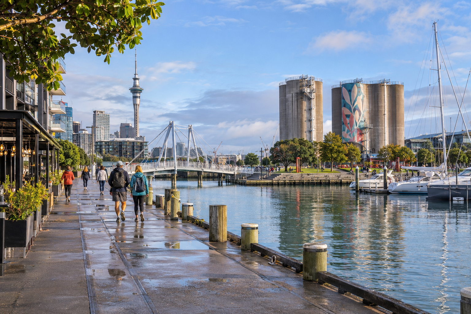
Auckland’s waterfront is one of the simplest places to understand how the city relates to Waitematā Harbour. This self-guided route links the heritage lanes around Waitematā Station, the Ferry Building and Te Wānanga, the marinas of the Viaduct, the Wynyard Crossing and the industrial landmarks of Silo Park. The direct distance is short, but public art, harbour views and optional museum stops make it worth allowing 2–3 hours for roughly 2.5 kilometres.
Why this Auckland waterfront walk works
The route is almost entirely on public promenades and connects well with trains, buses and ferries. Auckland Transport currently describes Wynyard Quarter and Silo Park as a 10–15 minute walk from Waitematā Station or the Downtown Ferry Terminal, via Quay Street, Te Wero Island and the crossing bridge. Check the official Auckland Transport access page before leaving because bridge openings, works and event arrangements can alter the most direct path.
Auckland waterfront walk: step by step
1. Waitematā Station and the old foreshore
Begin around Waitematā Station, still familiar to many travellers as Britomart. Before heading straight to the water, take ten minutes for Te Ara Tahuhu and Takutai Square. Restored brick warehouses sit beside newer buildings, revealing how the former foreshore and transport district have been reused rather than erased.
Walk through Te Komititanga toward the Edwardian Ferry Building and Queens Wharf. The harbour opens suddenly here: ferries cross toward the North Shore, while the city rises behind you. Auckland’s official visitor guide recommends this slower route through the heritage lanes and waterfront; see its current Waitematā Station neighbourhood guide.
2. Quay Street, Te Wānanga and Viaduct Harbour
Turn west along Quay Street. Pause at Te Wānanga, the coastal shelf with seating, planting and broad harbour views, then continue behind the New Zealand Maritime Museum and around the Viaduct. If you visit the museum, check its own hours and ticket information on the day rather than relying on an old itinerary.
The Viaduct is busiest around meal times, but the edges of the basin are the more interesting walking line. Look for working boats, pedestrian bridges and the contrast between superyachts and the city’s maritime infrastructure. Keep to signed routes where hospitality terraces narrow the promenade.
3. Wynyard Crossing and Karanga Plaza
Cross to Te Wero Island and use the Wynyard Crossing when it is open. This bridge can lift for marine traffic, so a short pause is part of the experience rather than a problem. At Karanga Plaza, steps descend toward the water and the view back to the skyline is particularly good in late afternoon.
Wynyard Quarter mixes public space, offices, restaurants and remnants of the working waterfront. Auckland’s tourism authority describes it as a transformed harbour neighbourhood with public art and family spaces; its official Wynyard Quarter guide is useful for current events.
4. North Wharf, public art and Silo Park
Continue along North Wharf, watching for the Wind Tree sculpture and other works integrated into the route. Finish among the former cement silos at Silo Park. The structures now frame exhibitions and seasonal events rather than hiding their industrial past. Auckland Council’s waterfront overview highlights the park, marina views and artworks; consult the official waterfront article for orientation.
If energy remains, extend west toward Westhaven Promenade. Otherwise, return along the same waterfront, take a bus from Wynyard Quarter or walk back to Waitematā Station.
Practical planning
- Best time: morning offers quieter promenades; late afternoon gives softer light across the harbour. Avoid exposed sections during severe wind warnings.
- Weather: Auckland can change quickly. Carry a light waterproof layer and sun protection; wet boardwalks may be slippery.
- Bridge access: Wynyard Crossing may open for boats or be affected by maintenance. Follow temporary signs and never enter a closed section.
- Accessibility: the main route is largely flat and suitable for wheelchairs and pushchairs, but detours, bridge operations and crowded terraces can add distance.
- Swimming: use only specifically designated facilities when officially open. Do not assume every harbour step or edge is safe for entering the water.
Continue exploring with Best Free Tour
Compare city experiences with the Best Free Tour city finder or browse self-guided and audio-friendly ideas. For more waterfront inspiration, save our Sydney Harbour walk and Vancouver Seawall walk.
Frequently asked questions
Is the Auckland waterfront walk free?
The outdoor route and public spaces are free. Museums, exhibitions and ticketed events may charge separately.
How long does the walk take?
Allow 2–3 hours with photo and art stops. A direct walk from the station to Wynyard Quarter is much quicker.
Can I do the route with a wheelchair or pushchair?
Most of the main promenade is level, but temporary detours or a closed crossing may lengthen the accessible route. Check current transport notices.
What happens when Wynyard Crossing opens?
Pedestrians wait while vessels pass, then the bridge reopens. Follow staff instructions and use the signed alternative if a longer closure is announced.